
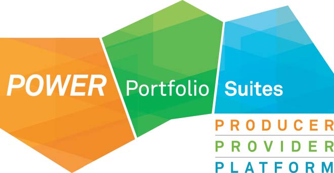
Hexagon Geospatial Power Portfolio

We are proud to formally introduce the Hexagon Geospatial Power Portfolio. The Power Portfolio combines the best photogrammetry, remote sensing, GIS and cartography technologies available into relevant Producer, Provider and Platform suites. Together, these three suites allow organizations to manage the full lifecycle of geospatial data management in new, game-changing ways. Now more than ever, we will enable our customers to derive even more information from their geospatial data. The Power Portfolio provides remarkable flexibility to hone in on the right tools needed to easily understand change, and derive the information required to make mission- and business-critical decisions.
Producer Suite
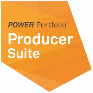
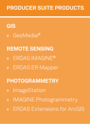
The Producer Suite empowers you to collect, process, analyze and understand raw geospatial data, and ultimately deliver usable information. This includes Hexagon Geospatial’s desktop-based GIS, remote sensing, and photogrammetry offerings.
GeoMedia Professional
GeoMedia is a powerful, flexible GIS management platform that lets you aggregate data from a variety of sources and analyze them in unison to extract clear, actionable information. It provides simultaneous access to geospatial data in almost any form and displays it in a single unified map view for efficient processing, analysis, presentation, and sharing. GeoMedia’s functionality makes it ideal for extracting information from an array of dynamically changing data to support making informed, smarter decisions.
Erdas Imagine
ERDAS IMAGINE, the world’s leading geospatial data authoring system, incorporates geospatial image processing and analysis, remote sensing, and GIS capabilities into a single powerful, convenient package. ERDAS IMAGINE enables users to easily create value-added products such as 2D and 3D images, 3D flythrough movies, and cartographic-quality map compositions from geospatial data.
ImageStation
The ImageStation software suite enables digital photogrammetry production workflows, including project creation, orientation and triangulation from aerial and satellite imagery. It provides stereo GIS feature collection and editing, digital terrain model (DTM) collection and editing, as well as orthophoto production and editing. ImageStation is specially designed to move large quantities of raw spatial information to an actionable or exploitable format for government, commercial photogrammetry, and mapping agencies worldwide.
Provider Suite

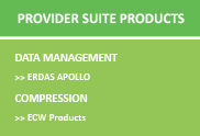
The Provider Suite gives you the power to manage your data.

Erdas Apollo
ERDAS APOLLO provides the greatest flexibility for geospatial data delivery, enabling dissemination into any client,on any device. ERDAS APOLLO connects the entire geospatial Power Portfolio of products to comprise a seamless, complete solution to geo-enable your enterprise.
ECW Products
High-performance image-compression format that reduces terabyte-sized imagery files to five-to-ten percent of their original size, while retaining full visual quality. Delivers lightning-fast display performance, and enables faster processing and transfer of imagery.
Platform Suite
The Platform Suite enables you to build your unique application on top of a solid foundation of powerful geospatial functionality. Using robust toolkits, detailed instructions and examples, and engaging with interactive developer communities, you can deliver solutions that can run on the desktop, in a server environment or on mobile devices and assist organizations in solving their day-to-day business problems.
The platform is used to visualize, geoprocess, and orchestrate that data through extremely simple and powerful workflows, ultimately providing the results of that processing and analysis to the end-user.
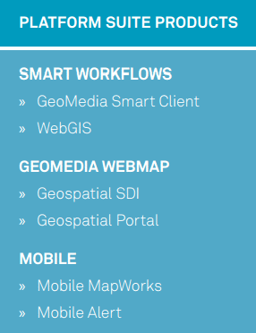
GeoMedia Smart Client
With GeoMedia Smart Client you can help organizations like that to save money day by day by providing a solution reflecting the internal processes and needs of the customer.
WebGIS
Hexagon Geospatial’s Web GIS integrates the power of
GeoMedia WebMap,Geospatial SDI,
andGeospatial Portal
products to provide:
Mobile
Embracing the ever-broadening capabilities of today’s mobile devices, we provide several pre-packaged, yet easily customizable, mobile applications.