Imago Global is partnered with 21AT to provide high quality archived and new tasking high resolution satellite imagery for your needs. We will assist clients in identifying the most suitable imagery for your domain.
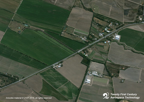
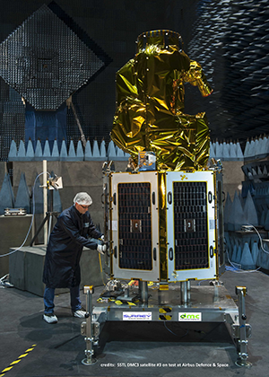
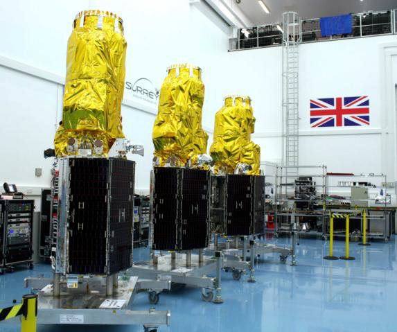
Twenty First Century Aerospace Technology Co., Ltd. (21AT) , a commercial Earth observation satellite operator based in Beijing, has bought the imaging capacity of three DMC3/TripleSat satellites that were designed and manufactured by SSTL. The very high-resolution imager on board the satellites will provide 1 metre ground sampling distance (GSD) in panchromatic mode, and 4 metre GSD in multispectral mode, with a swath width of 23.4km. The three satellites will be phased 120 degrees apart around the same orbit using their on board propulsion systems within three months after the launch; thus with off-pointing capability, the DMC3/TripleSat Constellation will be able to target anywhere on Earth once per day. In addition, the wide swath width of the satellites provides the best combination of spatial resolution and time resolution – aiming at stimulating operational monitoring applications, such as urban planning and intelligent management, based on changes detected by timely and regular cloud-free, very high-resolution imagery.